Roadbook: Delta to Vancouver
With its dense, ancient forest, the raw beauty of the coastline, and a vibrant metropolis, southwestern Canada brings different worlds together.
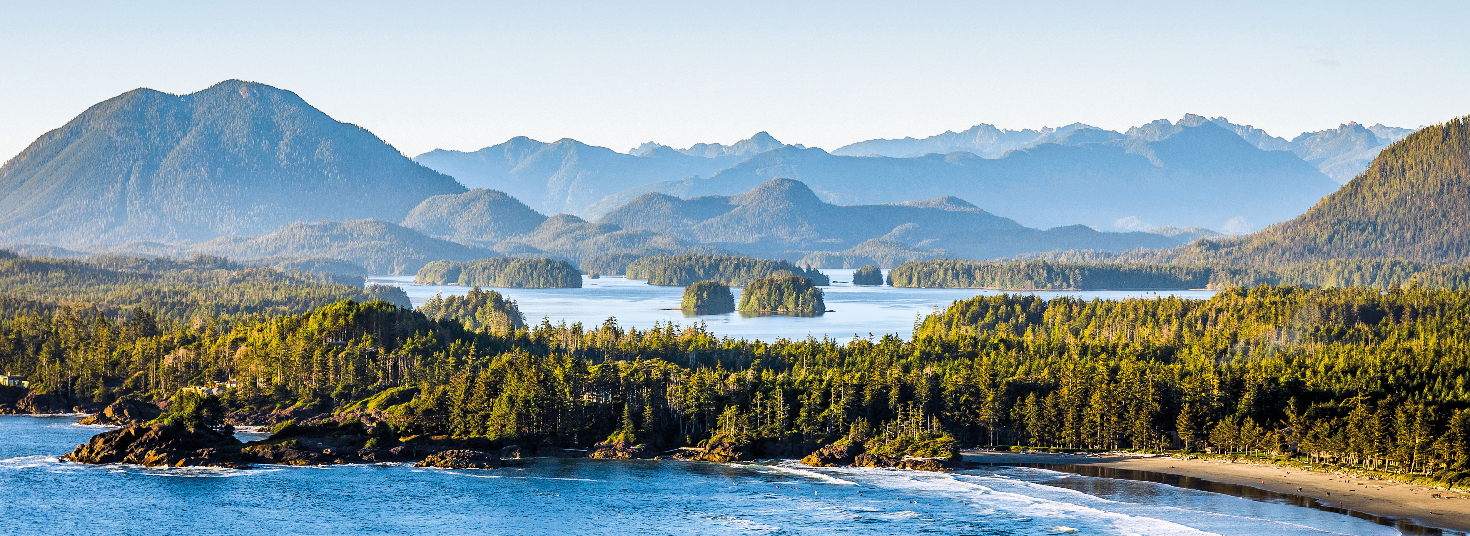
Vancouver Island is definitely worth a visit on a round trip, and there’s no better way to explore it than on the Pacific Marine Circle Route. “There you’ll find untouched landscape, lonely, winding roads, and the beautiful province capital.” Before embarking on our journey, we’ve consulted Garth Webber Atkins, the President of the Porsche Club of America’s Vancouver Island chapter. For her, the route is an absolute dream, alternating between a modern big city, lonely coastal roads, and untouched forest.
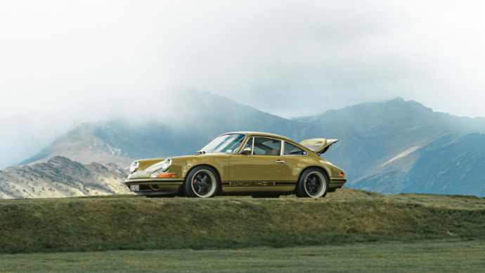
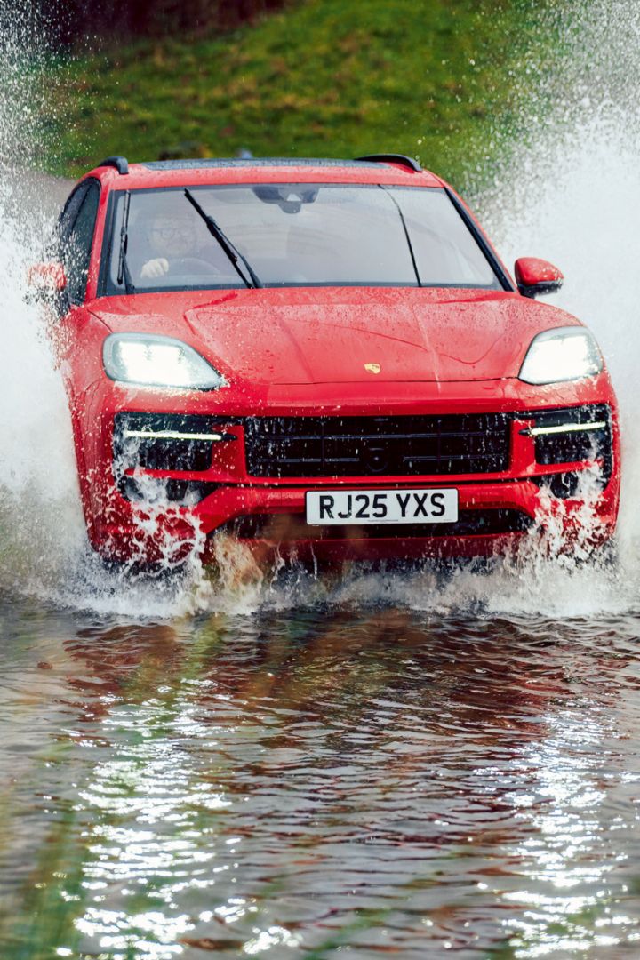
But the word “island” is deceiving. Vancouver Island is 100 kilometers wide and 450 kilometers long, making it a little bigger than Belgium. We have two ferry crossings to choose from for our trip, each about 1.5 hours long. Our plan is to head to the south of Vancouver, a city with a population of around one million, and take the ferry from Tsawwassen to Victoria (Swartz Bay), explore the spectacular nature on the southwestern tip of the island, and then take the ferry back up to the north of Vancouver from Nanaimo to Horseshoe Bay. Our road trip will kick off in the city of Delta, which is named after the Fraser River delta. Our car of choice is the Porsche Macan with the Canadian performance design in traditional white with black accents, which we pick up nearby. The SUV is spacious, but also compact enough for narrow roads, and suitable for occasional excursions on gravel tracks and stretches of beach, making it the ideal vehicle for our purposes.
An enjoyable drive:
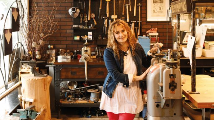
Luck is when everything comes together – a beautiful route, a picturesque landscape, and sunny weather.Before boarding the ferry, we take a brief detour to Steveston Village in southwestern Richmond, a city bordering Delta. There’s a brisk wind as we explore the fishing port and the surroundings of the city with its population of 220,000. We meet Sasha Shkolnik, a jeweler who immigrated to British Columbia from Ukraine via Germany years ago. “Life is just slower here,” she says about her new home. “Fish is sold directly from the boat, and boutiques have popped up alongside a selection of restaurants.” The 54-year-old has found a place to call home.
Forged with love:
With goldsmith Sasha Shkolnik’s help, couples can design and produce their wedding rings and other jewelry themselves at Juvelisto Design in Richmond’s Steveston Village district.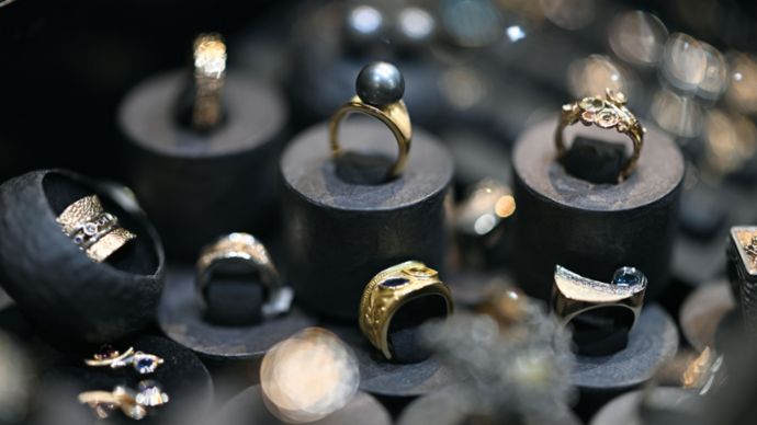
We get back in the car and head toward the Tsawwassen ferry port, which is just a stone’s throw from the US border. Once on Highway 99, we cross two arms of the powerful Fraser River, which carries 112 cubic kilometers of water and more than 20 million tons of sediment into the Pacific every year and, like many other rivers, is fed by melting snow from the Rocky Mountains. On clear days, the mountains form the fascinating panorama of the metropolitan region on the Pacific Coast.
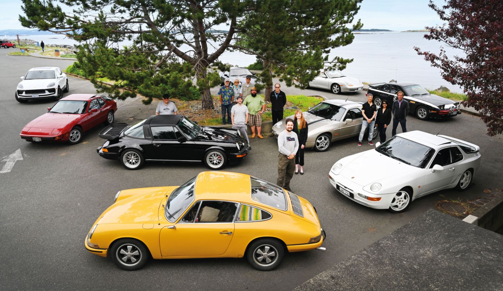
Our route takes us over the sea. The ferry port and the city district are named after the Tsawwassen First Nation, which roughly translated means “people with a view of the sea.” This is the home of the Tsawwassen, who belong to the Coast Salish, a group of ethnically related Indigenous peoples on North America’s Pacific Coast, with a history that goes back thousands of years. Once the ferry has wound its way through the smaller islands off the coast and docked at Swartz Bay, we head for Oak Bay Marina in Victoria, which is just over 30 minutes away. A small delegation of the local Porsche Club, including President Garth Webber Atkins, is waiting for us at the parking lot. The Porsche fans of Vancouver Island have had their own chapter with over 600 members that’s separate from that on the mainland since 1996. They have a range of club fleet vehicles with them, from the 968 Clubsport and a 928 to the classic 911.
Life on the coast:
Members of the local Porsche Club welcome us on our arrival in Victoria.“What a joy and honor it is to receive visitors from Stuttgart,” Webber Atkins tells us. After the warm welcome, we have the opportunity to get better acquainted with Victoria, the province capital, where the port extends deep inland.
Straight up and down:
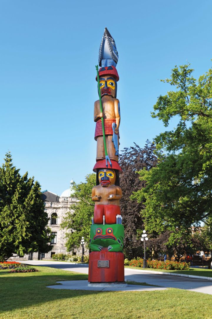
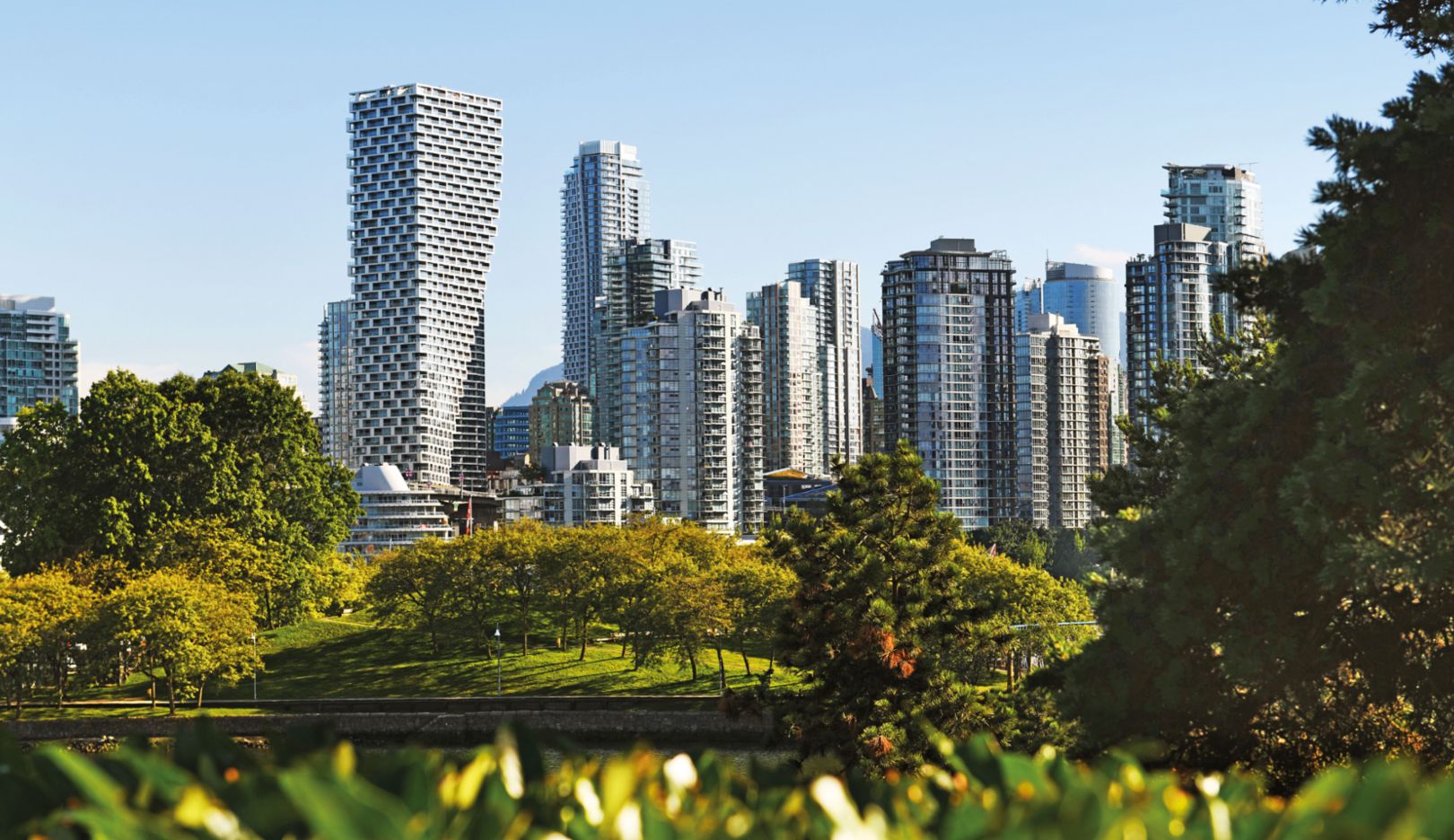
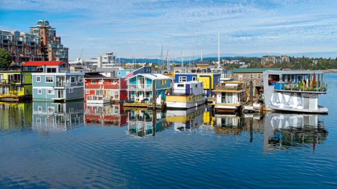
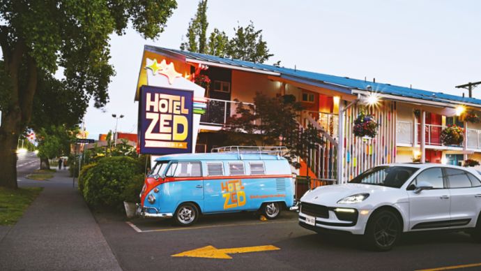
The totem poles on Vancouver Island are up to 53 meters tall. This 10-meter-tall totem pole in front of the parliamentary building in Victoria is called Knowledge Totem and was created by Cicero August of the Cowichan Salish tribe and his sons Darrel and Doug for the 1994 Commonwealth Games. In contrast, skyscrapers dominate Vancouver’s skyline. Designed by Danish architect Bjarke Ingels, Vancouver House is 150 meters tall and gradually transitions from the triangle of the plot into a rectangle.Imposing Victorian buildings such as the parliament and Fairmont Empress Hotel are lasting symbols of British settlement, which began in 1843 with the building of Fort Victoria by Hudson’s Bay Company. The urban landscape is dominated by structures in colonial style, the residential areas along the cliffs, and picturesque houseboats. The city’s relaxed atmosphere is palpable particularly at Hotel Zed, with an interior that breathes new life into the 1960s and its vintage VW buses parked out front. Victoria has been the island’s capital city since 1849, when the Crown Colony Vancouver Island was established, and remained the capital even after the island merged with the Crown Colony British Columbia (BC) in 1866. Measuring 920,686 square kilometers in size, the Canadian province of British Columbia is larger than any European country, yet its population is just five million.
Located in Thunderbird Park not far from the parliament building, Mungo Martin House was built in 1953 in the traditional Kwakwa₋ka₋’wakw style by Mungo Martin (1879–1962), who was the Indigenous peoples’ Potlatch Chief and just might be the First Nation’s most significant artist. The monumental totem pole he carved from a tree trunk and colorfully painted in 1953 is also impressive. Totem poles symbolize the position of a family in the tribe’s social hierarchy.
Built on water:
Colorful houseboats in Victoria Harbour are docked near the parliamentary building of the Province of British Columbia, whose Victorian style pays homage to the name of the capital city (below).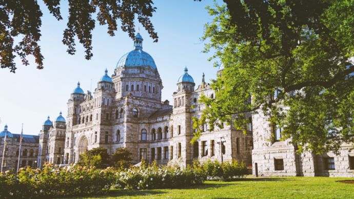
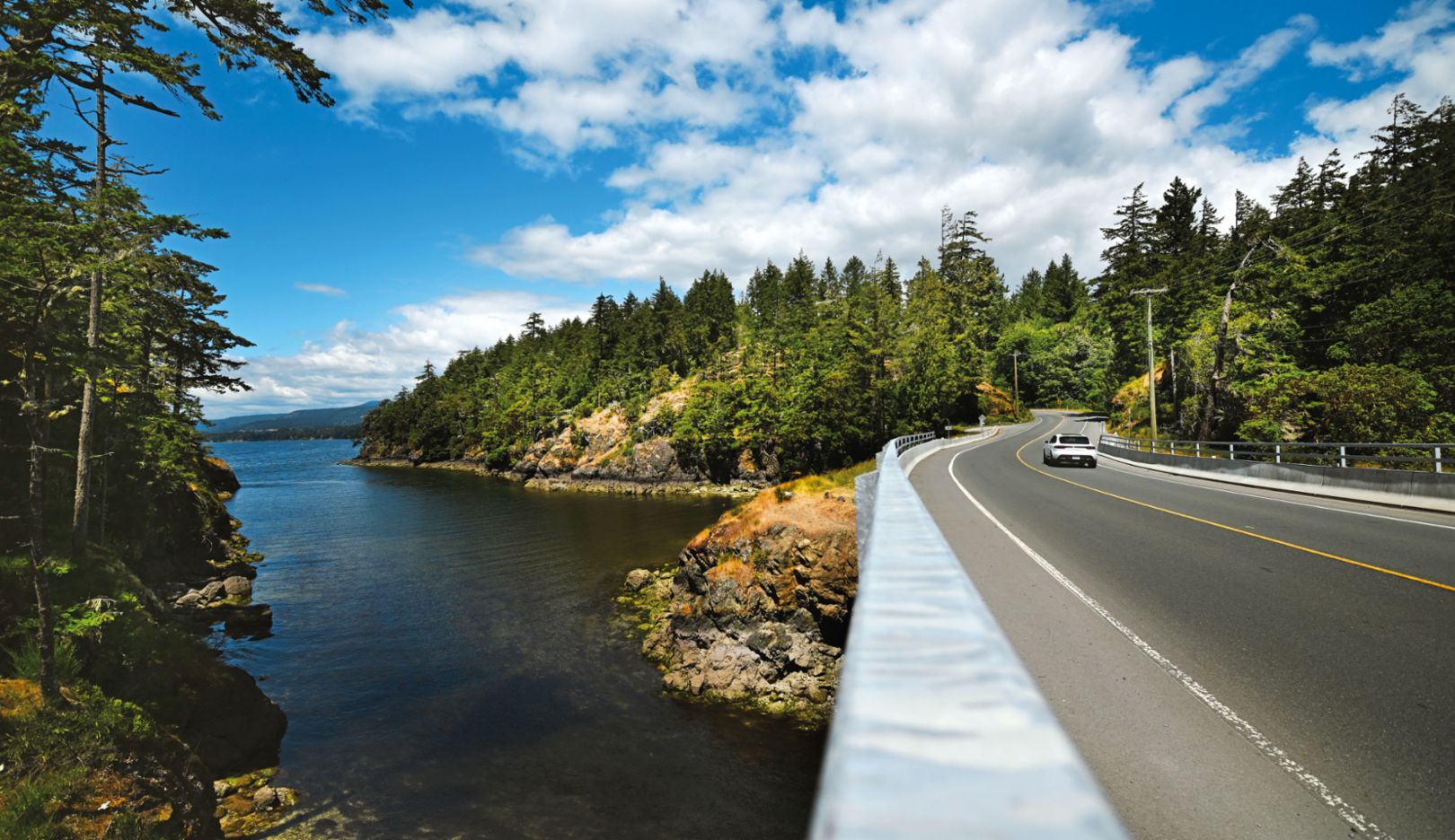
We take our leave and head for Sooke, a small town with surfing beaches, where we spend the night. The luxurious East Sooke Tree House located in the heart of the dense forest is like nothing else. We have the road there almost entirely to ourselves. Even though the bridges have just one lane, we never have to wait. Highway 14, which was an unpaved logging road until just a few years ago, follows the coastline to Port Renfrew. A higher vantage point provides a wonderful view of the Strait of Juan de Fuca and, beyond that, the Olympic Peninsula in the US. The West Coast Trail follows the shoreline and was created in 1907 as a faster route for assisting shipwreck victims. Storms and high waves can shift the kilometer-wide sandbank, which used to make that stretch of the coast unpredictable for sailors. They say there’s more than a hundred shipwrecks on the ocean floor in the area once referred to as the “Graveyard of the Pacific.”
Joie de vivre:
Hotel Zed in Victoria exudes the character of the 1960s, including references to the air-cooled age. It’s all about water sports at Seek & Surf in Sooke (below).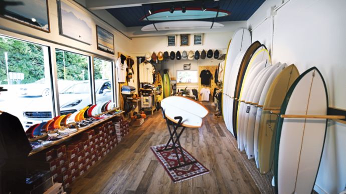
With its ups and downs, hairpin turns, and dips, even the highway itself can be challenging, but on nice days it offers unadulterated driving pleasure. The Macan’s steering translates the driver’s impulses to the road with precision, while the all-wheel drive offers plenty of traction when accelerating on tight turns. Distributing the power to all four wheels gives us peace of mind when we decide to take the Macan directly onto the rocky beach. The sporty SUV feels right at home on the fist-sized stones.
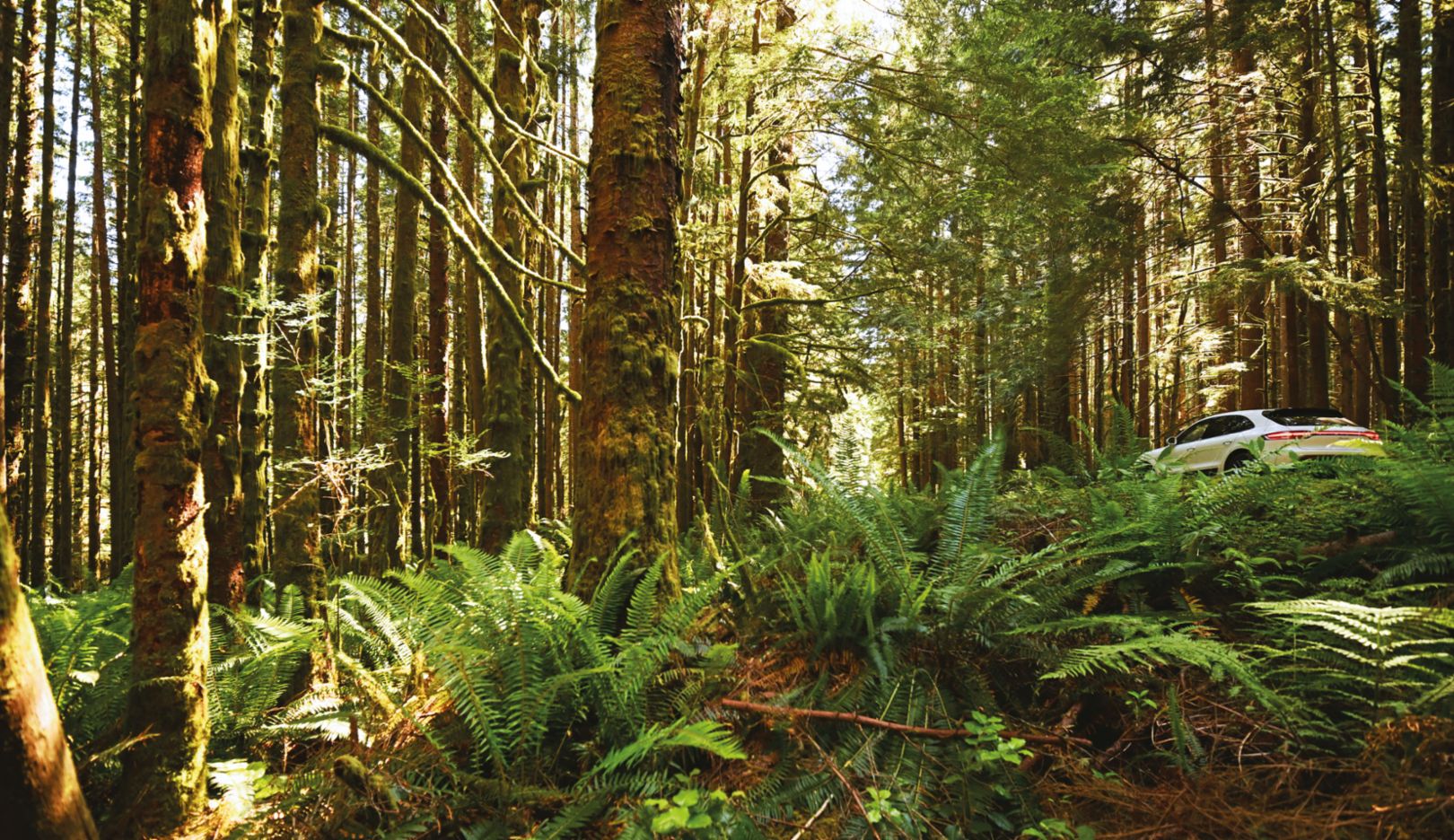
Here we’re surrounded by the spectacular nature of Vancouver Island – the salty air of the Pacific, mere yards away the slightly musty, highly earthy smell of the rainforest that surrounds us and filters out much of the sunlight, and then the strong, resinous fragrance of the warm pine needles on the forest floor.
Green oasis:
When the sun’s shining, you quickly forget why the forest on the Pacific Coast in British Columbia meets the definition of rainforest, which is at least 1,400 millimeters of rain a year.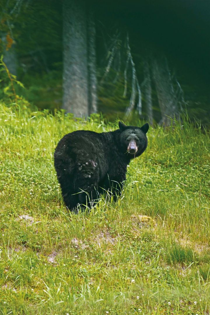
Carefree:
Black bears on the side of the road aren’t afraid of cars. There are more than 7,000 of them on Vancouver Island and more than 120,000 in the whole of BC.The coastal road comes to an end in Port Renfrew, where the Seaside Cottages offer the perfect opportunity to spend some time on the coast. Located directly on the shore, cozy chalets with a hot tub and private access to the beach offer a wellness experience in the heart of the wilderness. This is the ideal place to see whales in the sea, black bears in the forest, and eagles in the sky. The village has a population of 144 and is located at Port San Juan bay, where the river of the same name flows into the sea. Fishing has sustained people here from time immemorial, as has the timber industry since the arrival of the British. It’s worth mentioning that the only gas station on the nearly 130-kilometer stretch between Sooke and Lake Cowichan is located in Port Renfrew.
Nestled in the forest 15 kilometers away, one of the world’s largest living Douglas firs measures 73.8 meters in height and 13.3 meters in circumference and potentially has a thousand annual rings. Western red cedars tower high above and can be explored on trails. But be careful! Signs advise you to hold hands with children and keep dogs on a leash due to black bears and mountain lions.
Here, Highway 14 turns to the mountains in the north. The lonely forest road passes through 60 kilometers of untouched nature. The tourist infrastructure is only available again once you reach the town of Lake Cowichan on the banks of the lake of the same name, with its population of just under 3,000. There are a variety of waterfront eateries to choose from, from the traditional North American diner to the upscale fish restaurant. After a meal, we continue our drive to Departure Bay in Nanaimo, where we make our way back to the mainland. As we approach Horseshoe Bay, we’re treated to a breathtaking view of Vancouver and the surrounding massifs. Even Mount Baker, which is around 150 kilometers away, is visible.
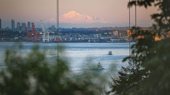
Rare sight:
Mount Baker illuminated in the evening light above Vancouver Harbour and the port facilities. The 3,286-meter-tall, snow-capped volcano in the US state of Washington is around 110 kilometers away.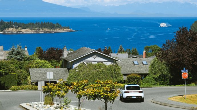
On the way back:
The port city that leads back to Horseshoe Bay on the mainland is called Nanaimo. Lions Gate Bridge crosses the strait at the start of the Burrard Inlet fjord, which extends 44 kilometers inland.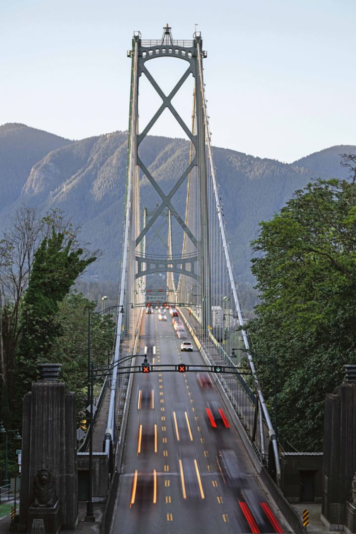
To reach our final destination, Vancouver, we need to cross the 44-kilometer fjord on the imposing Lions Gate Bridge. The road then leads through Stanley Park at the northern edge of the city, which is home to half a million trees and has been protected since 1886. Stanley Park offers 200 kilometers of paths and measures 404.9 hectares in size, which is equivalent to around 550 soccer fields, making it the largest city park in Canada and the third largest in North America.
Now we reach downtown Vancouver and cross another bridge over the False Creek inlet, which explorers incorrectly thought was a river. This is the small Granville Island peninsula. Once an industrial center, this shopping and cultural district is now a tourist attraction and well worth a visit, with a detour to the large market hall an absolute must. Like the many restaurants, the opportunity to explore False Creek with the small passenger ferries is just about impossible to resist.
And the view of the skyscrapers across the way is remarkable – Vancouver House designed by Danish architect Bjarke Ingels, in particular, is hard to miss. Built on a triangular plot, the 150-meter apartment building begins in a triangular shape and transitions to a rectangle as it reaches the top third.
This is where our journey comes to an end, a journey along a route that combines tradition with modernity as well as nature with grandeur. And where there’s still so much to discover.
Explore the route yourself
Discover the entire route in Canada in the Roads app.